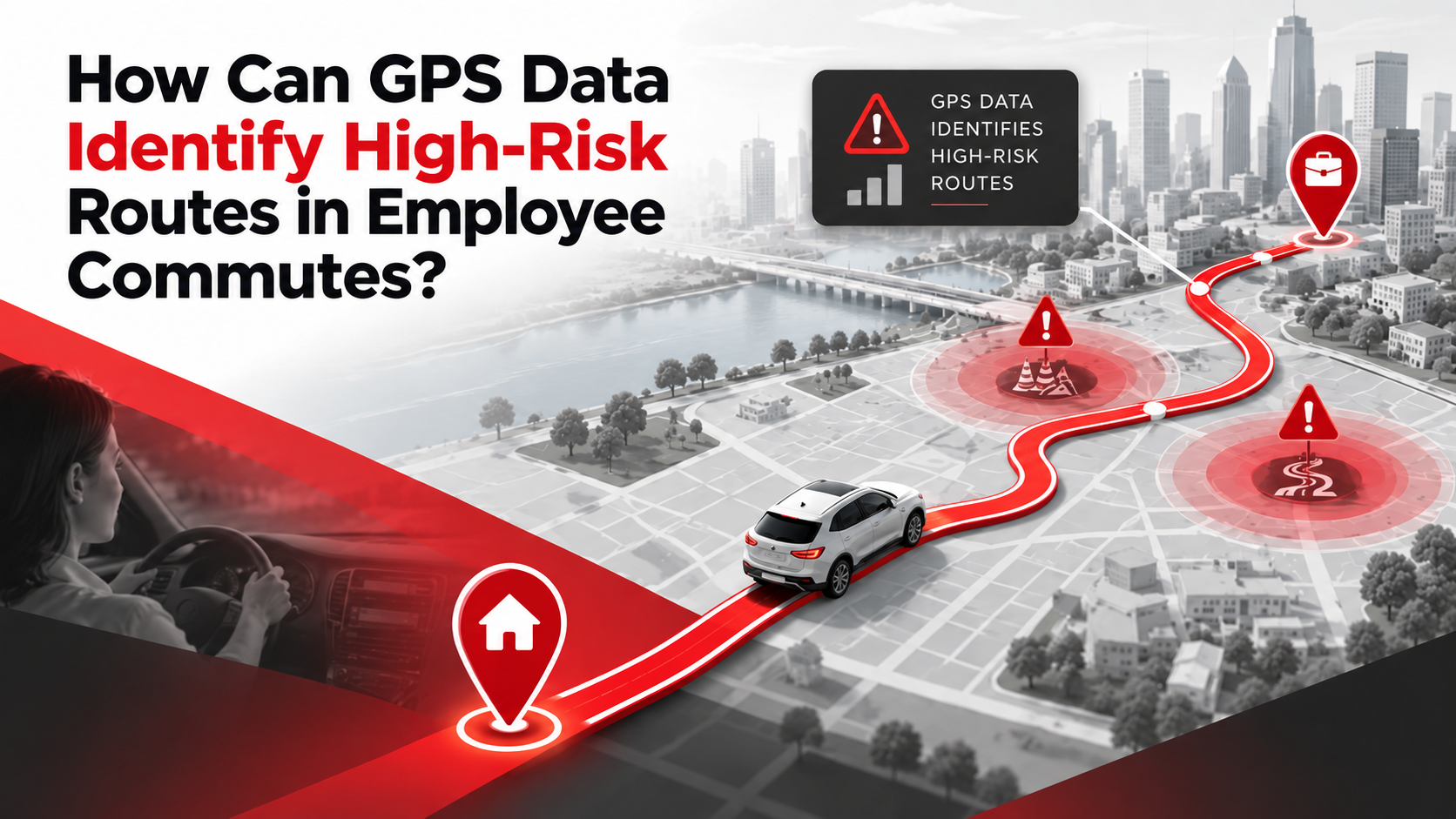
Employee transportation is an important part of workplace operations, especially for companies that provide daily pick-up and drop-off services. While arranging vehicles and routes may seem straightforward, employee safety during the commute requires much more than simply assigning a vehicle to a route.
This is where GPS data and route monitoring can make a difference. GPS tracking allows companies to understand how vehicles move across different routes and identify patterns that may create safety concerns. From frequent speeding and sudden stops to isolated roads and repeated delays, this data can help transport teams take timely action.
With the right use of GPS data, companies can make employee transportation safer, more reliable, and easier to manage.
Table of Contents
What is GPS Data in Employee Transportation?
GPS, or Global Positioning System, uses location information to track the movement of a vehicle. In an employee transportation system, GPS tracking devices installed in vehicles can provide real-time information about their location, speed, movement, and route.
This information can be collected over time and used to understand travel patterns.
For example, a company may notice that vehicles regularly slow down at a particular road section, take unexpected diversions, or experience repeated delays at certain times. When such information is studied together, it can help transport teams identify high-risk routes for employee commutes.
GPS data not only show where a vehicle is. It can also help answer questions such as:
- Which routes experience frequent delays?
- Where do vehicles regularly stop or slow down?
- Are drivers following approved routes?
- Which roads have unusual driving patterns?
- Are there areas where vehicles frequently deviate from planned routes?
- Do certain routes become more difficult or risky at specific times?
These insights can support better employee transportation management.
How Can GPS Data Identify High-Risk Routes?
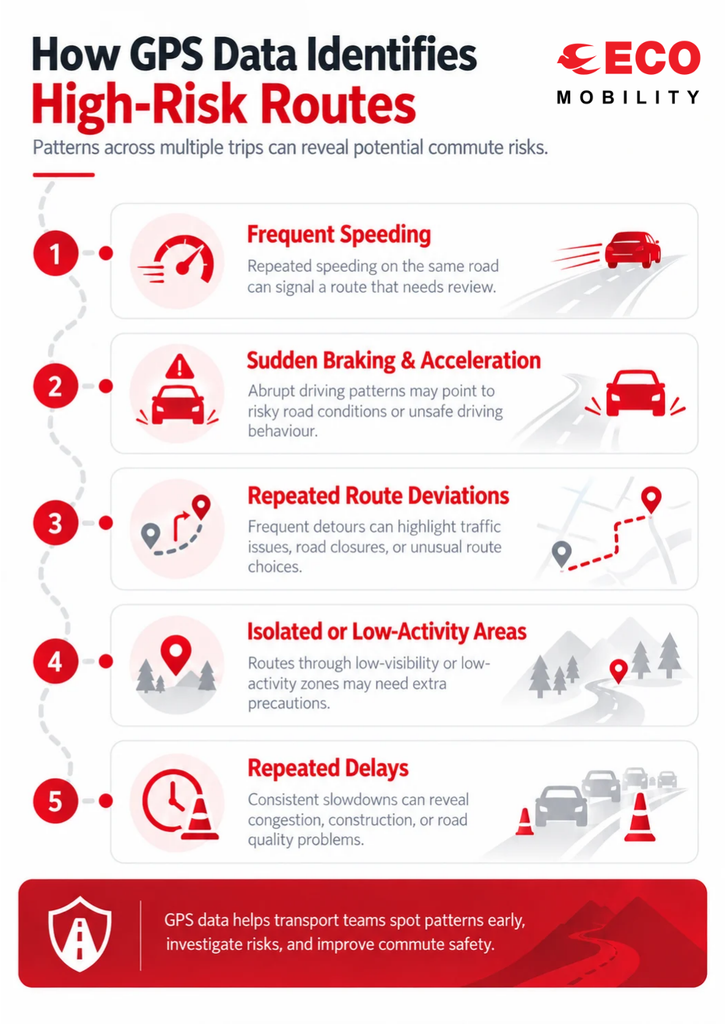
A single GPS record may not tell the complete story. The real value comes from studying data collected across multiple trips. When similar patterns appear repeatedly, transport managers can investigate the route more closely.
Here are some of the ways GPS data can help identify potentially high-risk commute routes.6
Tracking Frequent Speeding
Vehicle speed is one of the important data points available through GPS tracking. If a vehicle repeatedly travels above the company’s approved speed limits on a particular road, it can be flagged for further review.
The transport team can look at when and where speeding occurs. If the same road section shows repeated speeding incidents, the company can review the route, driver behaviour, and operating conditions.
This can help companies to take preventive measures instead of waiting for an accident or safety incident to happen.
Identifying Sudden Braking and Acceleration
Sudden braking and acceleration can indicate difficult road conditions, unexpected traffic movement, or risky driving behaviour.
When GPS and vehicle data show repeated instances of abrupt braking in the same area, the location can be reviewed more closely. It may point to a sharp turn, busy intersection, poorly managed traffic area, or another road condition that requires attention.
Studying these patterns can help improve employee commute safety.
Finding Repeated Route Deviations
Employees expect their transportation to follow planned and approved routes. GPS tracking can show whether vehicles are staying on those routes.
Repeated route deviations can be a reason for investigation. A deviation may happen because of traffic, road closures, construction, or a driver choosing an alternate road. While not every deviation represents a safety problem, frequent or unexplained deviations should be reviewed.
Route monitoring gives transport teams better visibility into what is actually happening during an employee’s commute.
Monitoring Isolated or Low-Activity Areas
Some routes may pass through areas with limited traffic, fewer public facilities, or low activity during certain hours. GPS data can help companies understand where vehicles are travelling and how often those areas are being used for employee transportation.
When location data is combined with company safety policies and local operational knowledge, transport managers can identify routes that may need additional precautions.
For example, a company may decide to use an alternative route during late-night employee transportation if it provides better visibility and easier access to assistance.
Studying Repeated Delays
Delays are not always a direct safety risk, but repeated delays can reveal problems with a route.
GPS data can show where vehicles regularly spend more time than expected. If the same location repeatedly causes delays, transport teams can investigate whether traffic congestion, road conditions, construction, or other factors are responsible.
This can help companies make better route decisions and improve the overall employee transportation experience.
Using Historical GPS Data for Better Route Planning
Real-time GPS tracking is useful during an active trip, but historical data can provide an even broader picture.
Companies can study previous journeys to identify patterns across days, weeks, or months. Instead of making route decisions based only on assumptions, transport managers can use actual travel data to understand how routes perform.
For example, historical GPS data may show that a particular route has:
- Frequent traffic-related delays during specific hours
- Regular route deviations
- Higher numbers of sudden braking events
- Longer travel times than alternative routes
- Repeated vehicle stoppages
- Inconsistent journey patterns
These patterns can help companies review their corporate transportation routes and make informed changes.
Combining GPS Data With Other Safety Information
GPS data becomes more useful when it is not viewed in isolation. A company can combine GPS information with other employee transportation data, such as driver feedback, incident records, traffic information, vehicle condition, and employee feedback.
For example, GPS data may show repeated sudden braking at one location. Driver feedback may reveal that the road has an unexpected turn or heavy pedestrian movement. Together, these insights provide a clearer picture of the potential risk.
This approach helps transport teams move from basic GPS vehicle tracking to more proactive safety management.
How Route Risk Analysis Can Improve Employee Safety?
The purpose of analysing GPS data is not simply to collect more information. The goal is to use that information to improve transportation decisions.
Once a potentially high-risk route is identified, companies can consider different measures based on the nature of the issue. These may include changing the route, adjusting the travel schedule, providing additional driver guidance, reviewing pick-up points, or increasing monitoring for specific journeys.
This creates a more proactive approach to employee transportation safety.
Instead of responding only after an incident, companies can identify unusual patterns early and investigate them.
GPS Tracking and Driver Performance
GPS data can also support better driver monitoring. Transport teams can review factors such as speed, route adherence, unnecessary stops, and driving patterns.
This information can help identify areas where drivers may need additional guidance or training.
Importantly, the objective should be to use transportation data as part of a structured safety process rather than treating every GPS event as a problem. Context matters. Traffic conditions, road construction, weather, emergencies, and other factors can affect driving behaviour.
A combination of GPS data and human review can therefore provide more meaningful insights.
Building a Safer Employee Transportation System
A strong employee transportation programme needs visibility across vehicles, drivers, routes, and daily operations. GPS tracking can provide an important layer of this visibility.
When transport teams regularly monitor route performance, they can identify changes and recurring patterns that may otherwise go unnoticed. This can support better planning, faster response, and more consistent safety practices.
For organisations managing large employee transportation operations, this becomes especially useful when hundreds or thousands of daily trips are taking place across different locations.
Technology can help bring this information together so that transport managers have a clearer view of daily mobility operations.
Conclusion
GPS data can play an important role in identifying potentially high-risk routes in employee commutes. By analysing vehicle speed, sudden braking, route deviations, travel times, stoppages, and recurring route patterns, companies can gain useful insights into how their transportation network is performing.
However, GPS tracking alone does not determine whether a route is safe or unsafe. The data needs to be reviewed alongside driver feedback, operational information, incident records, and other relevant safety factors.
When used properly, GPS tracking and route monitoring can help companies take a more proactive approach to employee transportation management. It can support better route planning, improve visibility, and help organizations create safer and more reliable daily commutes for their employees.
For businesses looking to strengthen their corporate employee transportation, combining technology with trained people, clear processes, and regular route reviews can create a more effective approach to mobility management.